
Forensic Technology & Measurement Equipment
Why this tool matters in court
Gerald McDevitt documents scenes with a Sokkia reflectorless total station, high-resolution digital cameras, and Recon3D handheld LiDAR scanning.
Equipment such as the Emlid Reach RS3 GNSS receiver, the Recon3D iOS-based LiDAR scanning application (used for 3D documentation of vehicles, rooms, buildings, and limited-range scenes), and the Autel EVO II Pro RTK V3 drone supports ground and aerial data collection.
This data is brought into reconstruction software to produce scaled diagrams and 3D models, with the accuracy of each measurement documented.
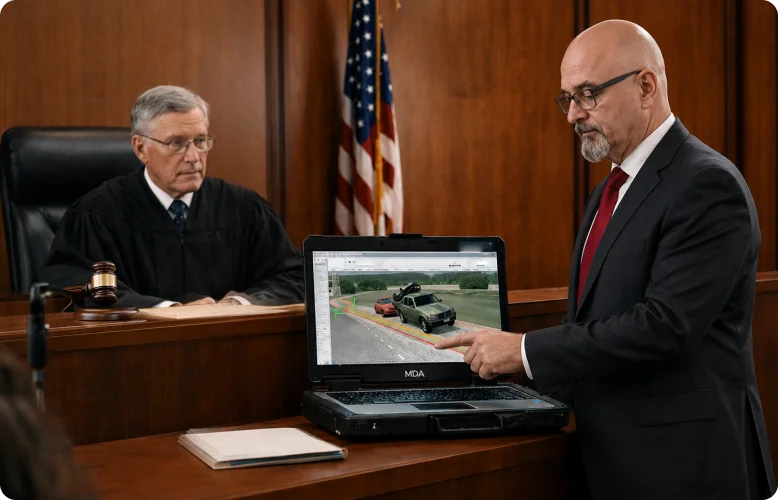
Reconstruction Outputs & Courtroom Exhibits
All outputs are developed or directly reviewed by Gerald C. McDevitt, with the methodology documented so it can be examined under the applicable admissibility standards.
LiDAR Point Cloud Mapping
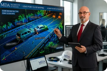
Gerald McDevitt produces 3D point clouds of vehicles and limited-range scene elements using Recon3D LiDAR scanning. When third-party LiDAR point cloud data is received through discovery, it is imported and processed using FARO Zone 3D Expert Plus software. Point cloud outputs support measurement, scene visualization, and integration with other forensic data sources for a complete 3D record of the scene.
3D Reconstruction Models
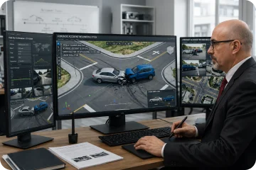
Gerald McDevitt builds 3D reconstruction models that combine Recon3D LiDAR data, Emlid Reach RS3 GNSS positioning, Autel RTK drone photogrammetry, and Sokkia total station measurements. The models depict roadway geometry, vehicle positions, sight lines, and physical evidence in three dimensions, with each input documented to the accuracy of the instrument that captured it.
Crash Data Retrieval (EDR/CDR Reports)
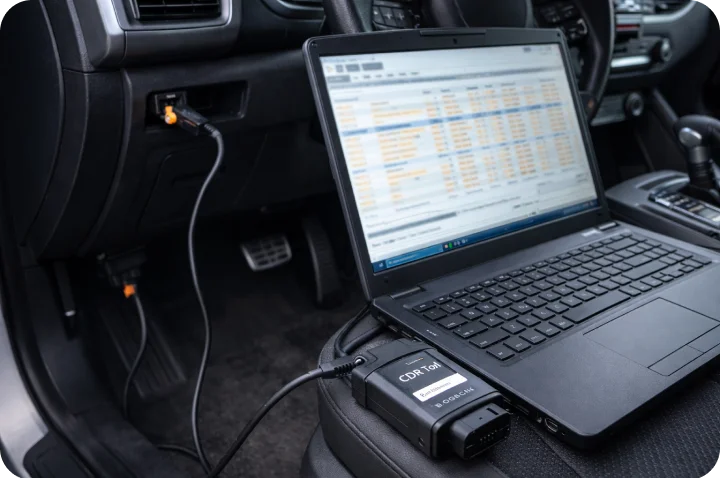
Gerald McDevitt retrieves and interprets event data recorder (EDR) and airbag control module (ACM) data using the Bosch Crash Data Retrieval (CDR) tool. When a collision triggers a recorded event, reports can document pre-crash indicated speed, brake switch status, accelerator position, seat belt buckle status, air bag deployment timing, and delta-V, read within the module’s limits and checked against the physical evidence.
Courtroom Animation & Demonstratives
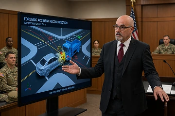
Gerald McDevitt develops 3D animations and courtroom demonstratives that translate the underlying forensic data into clear visualizations for judge and jury. Animations are built from the measured scene data — point clouds, GNSS coordinates, and EDR records — so each element can be traced to the evidence.
CORE TECHNOLOGIES
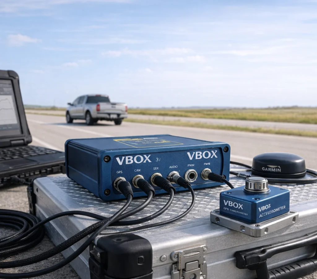
RACELOGIC VBOX GPS DATA LOGGER / ACCELEROMETER
Gerald McDevitt uses a Racelogic VBOX GNSS data logger in vehicle testing, such as exemplar speed, acceleration, and braking runs, to measure speed, acceleration, and braking with a calibrated instrument.
High-frequency test data allows vehicle performance to be measured rather than assumed, and compared against EDR data and physical evidence.
Primary use
- Exemplar speed and acceleration testing
- Braking and deceleration testing
- Test-run position and timing data
- Comparison with EDR data and physical evidence
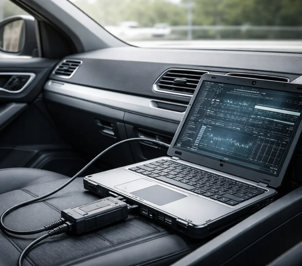
Crash Data Retrieval (EDR / CDR)
Gerald McDevitt uses the Bosch Crash Data Retrieval (CDR) tool to retrieve recorded pre-crash and crash data from a vehicle’s airbag control module (ACM) or event data recorder (EDR). EDR data is often central in vehicular homicide, DUI fatality, and disputed-fault cases, when a recorded event exists. The Bosch CDR tool connects through the vehicle’s diagnostic port or directly to the module. Depending on the vehicle, the record can include pre-crash indicated speed, brake switch status, accelerator position, seat belt buckle status, air bag deployment timing, and delta-V. Data interpretation is performed by Gerald McDevitt, read within the module’s limits, and checked against the physical evidence.
Primary use
- Pre-crash indicated speed
- Brake switch status and accelerator position
- Seat belt buckle status
- Delta-V (change in velocity)
- Air bag deployment timing, where recorded
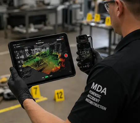
3D LIDAR SCANNING (RECON3D)
Recon3D is an iOS-based LiDAR scanning application used for 3D documentation of vehicles (interior and exterior), rooms, buildings, and limited-range scene elements. Gerald McDevitt uses Recon3D with the LiDAR sensor built into Apple devices; each scan is scaled to AprilTag targets placed at a known distance. It is suited to close-to-mid-range documentation where portable scanning is needed.
Primary use
Accident and crime scene documentation where precision and clarity are critical.
Range
Effective for close-to-mid-range 3D documentation of vehicles, rooms, buildings and scene elements.
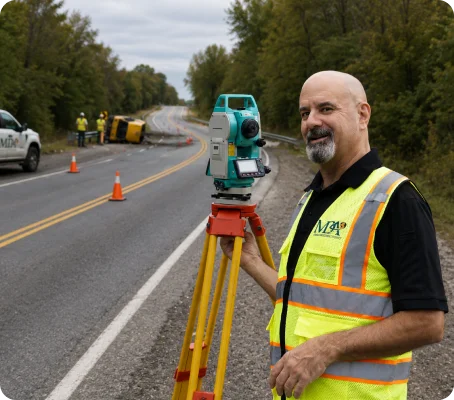
TOTAL STATION MEASUREMENT — SOKKIA SET330R3
Gerald McDevitt documents scenes with a Sokkia SET330R3 reflectorless total station, maintained and calibrated to manufacturer specification. Reflectorless measurement allows evidence to be recorded without placing personnel in the roadway.
Primary use
Evidence-grade measurement — point of impact, tire and roadway marks, gouges, fluid and debris distribution, and final rest positions.
MEASURING RANGE
Reflectorless: 0.3 to 350 m (1,140 ft) to a white target; 0.3 to 170 m (550 ft) to a gray target
Prism: 1.3 to 4,000 m (13,120 ft) with standard prism
Reflective sheet: 1.3 to 500 m (1,640 ft)
ACCURACY (fine measurement)
Prism: ±(2 + 2 ppm × D) mm
Reflective sheet: ±(3 + 2 ppm × D) mm
Reflectorless, white target: ±(3 + 2 ppm × D) mm from 0.3 to 200 m; ±(5 + 10 ppm × D) mm from 200 to 350 m
Reflectorless, gray target: ±(3 + 2 ppm × D) mm from 0.3 to 100 m; ±(5 + 5 ppm × D) mm from 100 to 170 m
Minimum display resolution: 0.001 m (0.01 ft / 1/8 inch)
(D = measurement distance)
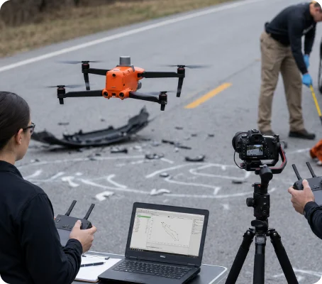
Autel EVO II Pro RTK V3 drone / UAV photogrammetry
Gerald McDevitt uses an Autel EVO II Pro RTK V3 drone with RTK/PPK geotagging to capture aerial imagery of collision scenes for photogrammetric processing.
Aerial imagery is processed into orthomosaic maps, dense point clouds, and 3D surface models. The accuracy for each scene is reported from its ground control residuals and check points.
Aerial data is captured with an Autel EVO II Pro RTK V3 and processed photogrammetrically into orthomosaics, dense point clouds, and three-dimensional surface models. RTK and PPK geotagging, together with ground control points established using the Emlid RS3 GNSS, tie the aerial dataset into the same coordinate framework as the total station and GNSS measurements. Aerial and ground-collected data can therefore be measured directly against one another rather than treated as separate records.
Primary use
- Aerial scene documentation
- RTK/PPK-geotagged mapping
- Orthomosaic & 3D model generation
- Dense point cloud data for analysis
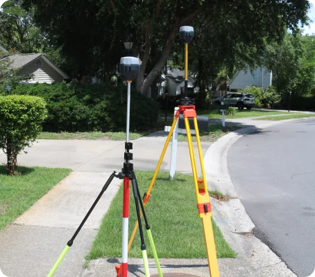
GNSS RTK & PPK Mapping (EMLID REACH RS3)
Gerald McDevitt uses an Emlid Reach RS3 GNSS receiver with RTK and PPK workflows to record coordinates for scene mapping, roadway geometry, and evidence documentation.
Positions are recorded at centimeter-level accuracy with a fixed RTK solution, and validated through post-processed kinematic (PPK) processing.
Emlid RS3 GNSS is used for scene-scale mapping — roadway geometry, sight distance, grade and superelevation, ground control point placement, and overall scene extents — at centimeter-level accuracy validated through post-processed kinematic (PPK) workflows.
Primary use
- Scene mapping
- Evidence point collection
- GCP placement
- PPK accuracy documentation
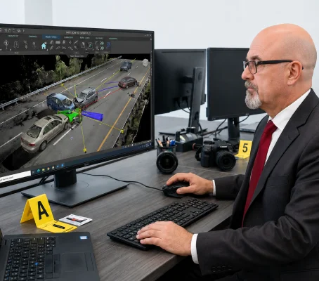
FARO ZONE 3D EXPERT PLUS
Gerald McDevitt uses FARO Zone 3D Expert Plus software for importing and processing LiDAR point cloud data received through discovery or from collaborating experts. This software enables integration of third-party LiDAR scene data into the reconstruction workflow for analysis, measurement, and courtroom presentation.
Primary use
- Importing and processing LiDAR point cloud data
- Scene measurement and analysis from third-party scans
- Integration with reconstruction software.
Technology Used by Gerald C. McDevitt
Every dataset, model, and reconstruction presented in court is developed under the direct oversight of Gerald C. McDevitt, with the method and accuracy of each measurement documented.
- Methodology developed to meet Daubert and Frye admissibility standards
- Measurement accuracy documented per instrument and per method
- Integration of multiple data sources (LiDAR, Emlid RS3 GNSS, EDR)
- Reconstruction workflows aligned with industry standards
- Expert interpretation backed by 32+ years of experience
Data from all three measurement systems is combined into a single coordinate framework, with each measurement documented to the accuracy of the instrument and method that captured it.
Discuss Your Case
If you are evaluating an accident reconstruction expert for litigation, consultation, or case review, contact Gerald McDevitt directly for a confidential discussion.